Review by Ariadne Gallardo Figueroa
This work recounts the two trips made to Nepal facilitated by KE Aventures Travel, undertaken in autumn 2001 and October 2004; the second alongside Tim Scott, an enthusiastic hiker and personal friend of the writer. Soon we will see a more extensive work titled 'Travels in Time and Space' that the writer Clive Simpson is currently preparing. Four decades of travel and writing must be recounted in it.
With an interesting dedication, I have received the book by the renowned author and writer Clive Simpson: “Ariadne, The mountains of your mind, call”. It is therefore the author's central idea when faced with the immensity of the Himalayas.
Later, his work highlights from the outset the recognition of his parents who urged him from a young age to recognise the power of travel and their enigmatic way of teaching customs and
landscapes that were not. They are common every day.
The back cover surprises with a beautiful epigraph, it is as if the author decided to place a
ribbon around the work before presenting it to the reader subtly and elegantly. It is the also
British John Ruskin who declares: “And of these great cathedrals of the earth, with doors of rocks, pavements of clouds, choirs of steam and stone, altars of snow and a purple vault crossed by the continuous stars.”
I then realize that it is his cultural background and what he learned from his ancestors who have given that mystical and religious character to the adjective that he has given in his title to the large masses of rock that have not been manufactured by human hands but as part of the geological process where orogenesis allows two huge plates of Earth to rise and remain stable for thousands of years.
Many films and books have been written about the Himalayas, each with a different vision. The most revealing thing about each author is that he shows us his vision through words and we are left meditating on the experience that transmits to each of us.
Clive Simpson, who bears in his name the courageous sign of the great mountain crags, points
out that a group had to return to Spain without achieving the objective due to the difficulties in reaching the summit; then he describes the paraphernalia of all the little coloured flags that are moved by the gusts of wind, pointing out that they are still there, that the achievement is possible and that you just have to know when to climb.
Pages later describe in detail the health problems of a young Scotsman who, despite being 19
years old, is under the influence of mountain sickness that causes so much discomfort in those who suffer from it.
The Nepalese slope of Khumbu rises 5,486 meters above sea level, being in front of it must be
an invaluable experience, Clive mentions it, but does not give much information about its
characteristics, perhaps surprised by its majesty, initially points out that it is a sunny day in
November, the mere idea sticks in the mind of the reader and makes us recognize that that
section will not be crossed during the midday thaw.
Before the immeasurable expression of the landscape, Clive Simpson takes a tour of the travel
experience from London airport to the different landscapes and culinary smells that will bring
you closer to a new and different territory, where curry is served regardless of the time of day.
day or night, in the same way, and if dwelling on too many details describes the aviator's ability to achieve manoeuvres that would seem crazy and reckless to the most sensible person.
Kathmandu at 1,400 meters above sea level becomes for them as visitors the threshold to the
mountainous space of the Himalayas, the author describes the artistic nature of its buildings and I imagine that being there arises within their being a hunch of hope and excitement of the
moment of inhaling the icy breath of the ice colossus.
The dense fog southeast of Dhaka in Bangladesh leaves me thinking about those who accompany him, since I only spell “We” at various times, the privacy of the group seems important or the landscape is more captivating than any human being surrounding their path. Without a doubt, the selective vision of the landscape is one of the amazing moments of the experience.
I discover that there are approximately 20 people in addition to the pilot, Clive describes them as 'Virgins of Everest', the phrase seems surprising, placing confidence in the skill of the Yeti Airlines pilot, all of them unknown to the mountain peaks that receive them indifferently.
On the left side of his window, Clive describes the frozen peaks almost touching the aircraft. It
must be a unique sensation to be in the flight of the metallic bird, recognizing the close touch of the imposing cliffs.
The description is so faithful that I feel the hum of the aero motor in my mind, slowly and calmly travelling through that new and surprising space. Changes of ice and cold are carried by hanging notes where in the distance you can hear the thundering water guessing in a gorge and the Sherpa hike leader who gives instructions that just imagining the way he describes them has made me nervous.
For Clive, adrenaline is everything, imagining himself rising with the group to the top
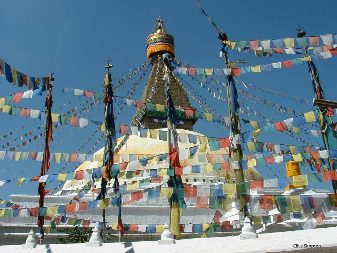
encourages him, and every detail is a new adventure. “Everest” is not everyone a recognized name for the mountain group, among the Nepalese, its name is Sagarmatha and when they get there, they discover a national park protected since 1976, where it is necessary to use Yak dung to heat food. It must be protected as a world heritage site and for this it is necessary to establish ecological care that all hikers should respect.
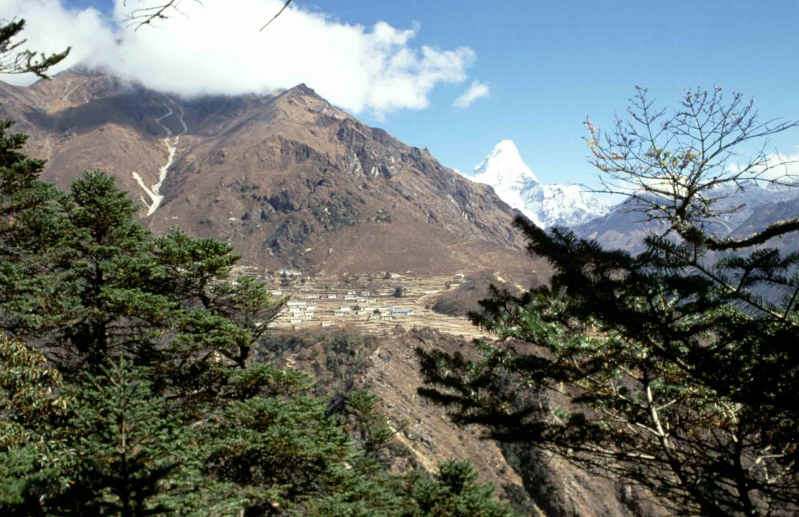
Sagarmatha is the name in Nepal for this imposing peak. It means “mother of the universe” in
Sanskrit. Along the way we found a pine forest and the 150-meter ascent through the colourful Namche, everything seemed to indicate that life provides enough strength to move forward, but the discomfort arrived and found us in its camp, a painful head with seized some of the hikers, the height subdues the most reckless.
During a journey that seems worthy of the most courageous humans capable of acting in the
face of tremendous cliffs and climatic extremes, David's illness contrasts with the name of the
one who prevailed against Goliath; making a comparison in those latitudes, when it is necessary to take him to a hospital, to receive a second opinion due to the deterioration of his health. The contrast shows the reality of a world that is not made for everyone, regardless of age and vitality.
Something stuck in my mind in a particular way, the moment in which the writer worries about the state of health of the young man who is finally taken to a hospital in Kathmandu, and another detail that seems irrelevant but that shows me Clive's strength when he points out that at a certain height, he decides to use a second pair of socks, I remember my climb to the Nevado de Toluca in my own country and the need to wear mountain boots with three pairs of socks that did not fulfil their purpose and there, I realize that the Himalayas are not for everyone.
It is a feat that deserves patience at every step of the way. Tengboche is a monastery set against the backdrop of the Khunde Canyon. It is located directly adjacent to Khumjung, in the valley at the foot of Khumbu Yül-Lha, the mountain sacred to the Sherpas. The Khumjung Valley is between 3,800 m and 4,000 m above sea level. Khunde is located in the western part of the valley and slightly higher than Khumjung.
Carrying a heavy backpack on your back causes pain in the lower part of the neck, headaches
are a general trigger among hikers who need to hydrate with something that contains sugar, and crossing a raging river over a bridge has to be one of the experiences more powerful, and Clive discovers it in detail, the guide decides, given the group's stomach ailments and headaches, to spend the night in Dingboche.
The encounter with their settlement at 4,267 meters high (approximately 14,000 feet high) leaves many of us readers wanting to see that crescent moon on the shoulders of the mountain, there is no photograph of that fascinating event that remains reserved for the eyes. of hikers, a clear, starry night that perhaps becomes the setting for a peaceful night in the small settlement of stone huts at Ama Dablam.
Ama Dablam is affectionately known as the "Mother's Necklace" among the Sherpas, a term
loaded with cultural meaning. This name is derived from the Sherpa language, where "Ama"
translates as "mother", and "Dablam" refers to a double pendant worn by Sherpa women that
holds images of gods. Without a doubt, the stars fulfil a beautiful image among visitors and this fascinating and traditional necklace.
Approaching the autonomous region of Labouche urges me to imagine that peak recognized as the 93rd mountain peak that has not yet been able to be climbed by humans due to the dangers it implies, being able to see it from the front must have been one of the most impressive events for a British visitor.
The Kala Patthar climb is very popular among trekkers in the Mount Everest region as it offers the clearest view of Everest. Kala Patthar, meaning “black rock” in Nepali and Hindi, is a mountain in the Nepalese Himalayas.
Then the usual breakfast of sweet potatoes and cabbage dwindles to tea and biscuits, and the
climbers' stomachs can't handle it anymore, each journey is a physical effort and an admirable moment for each of them. Just thinking that this path was crossed by the most renowned climbers in the world made the journey full of enthusiasm.
The mere idea of imagining the Sherpas, willing, happy, and accustomed to doing this work
continuously to accompany the intrepid visitors. It is interesting, that Clive discovers it as a sign of humility for each of them. Reaching 5,638 meters, approximately 18 thousand feet high is not something that is told to be left in the memory, documenting it and sharing it is the most fascinating thing that Clive has made us part of a unique event, even though I will always miss the shot of the crescent moon.
* * *
This is an un-edited review auto-translated from Spanish and originally published on ‘Letras Creativas con Ariadne Gallardo Figueroa’ blog (April 2024) under the heading “Tierra de Grandes Catedrales”, Reseña a la obra de Clive Simpson.
Click on link to order a limited edition, signed copy of Land of Great Cathedrals